After our Milford Sound cruise, Andy and I took our time driving back to
Queenstown and spent several days exploring Fiordland National Park.
Note: There are a
number of companies that provide transportation from Queenstown to
Milford Sound and back. If you are short on time, this can be a
pretty efficient way to see Milford and parts of the national park.
Here are a few
pictures we took from several different viewing points on the Milford
Road:
However, if you
ever plan on visiting Milford Sound and time constraints are not an
issue, I highly recommend driving there yourself. The reason for
that being you miss a lot by going on a tour, including great walks
like the one we did on Andy's birthday!
On the morning of
Andy's birthday (March 5th),
we woke up to this amazing view of Lake Gunn, where we had camped the
night:
The plan was to go
on one of the “Great Walks” in Fiordland; either the Milford or
the Routeburn Track. I later learned that the start of the Milford
Track was only accessible by boat... so Routeburn it was!
Since the Routeburn
Track normally takes 2-4 days to complete, we of course did not walk
the entire distance.
 |
| The start of the Routeburn Track at the Divide |
Instead, we decided
to follow the track for about an hour before branching off and hiking
the much shorter Alpine Key Summit Walk.
I could break this hike down into four sections:
1.) The first part of the hike was particularly intense. It was a
fairly steep climb through a forested area with a lot of weaving back
and forth as we made our way up the mountain. If I had to put this
section of the hike on a scale from 1 to 10, I would rate it at a
“5”.
Don't get me wrong- it was beautiful:
There were a few small waterfalls here and there, but visually, the
pay-off was minimal... compared to what was to come.
2.) The second part of the hike was right after we took the turn-off
to Key Summit. This was when we started to forget our aches and
pains... because once we got above the treeline, this view offered a
great distraction:
This part of the hike was still steep, but because of the view, I would rate this section a “7”.
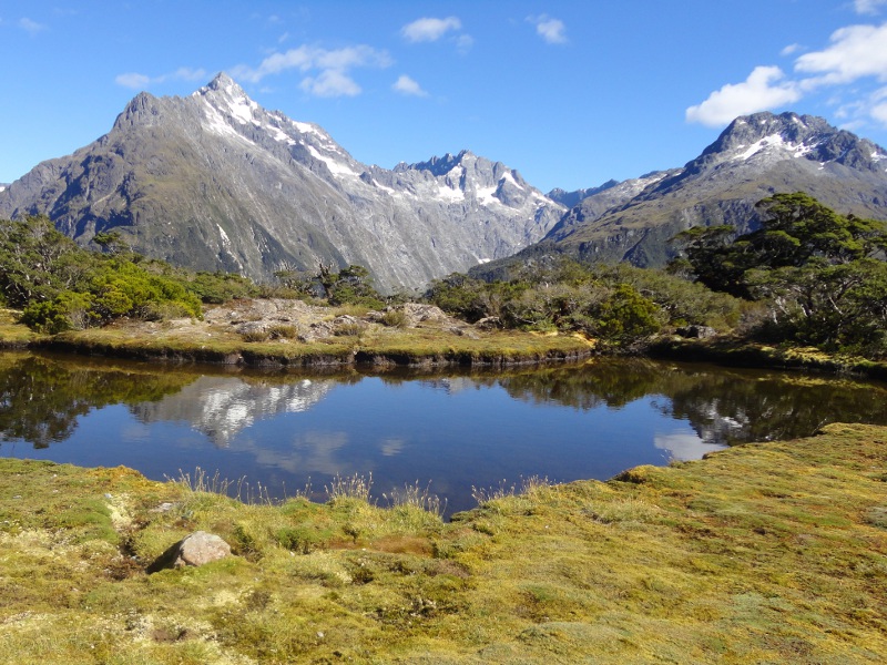
3.) The ground levelled as we reached the third part of our hike:
the start of the self-guided alpine nature walk.
It's hard to describe the beauty of this place. With all the places we'd been to, I felt like I'd run out of adjectives to do this place justice. Until Andy took this panoramic shot and proclaimed “glorious!” Thanks, hon!
I will let the pictures speak for themselves:
This part of the hike was relatively flat and the scenery was
spectacular! I give it a solid “9”.
4.) What we didn't realize at the time was that there was a section
4. Most people who reached level 3 ooh'ed and ahh'ed over the
scenery, took a dozen pictures, and started the descent back down the
mountain. But Andy saw what looked like a path that disappeared into
a heavily forested area and decided to venture in and see where it
led...
So off we went, fighting our way through dense foliage. Several
times, I questioned whether this path was even still in use and
whether or not we should turn back. But after awhile, we finally
broke out of the trees and found ourselves on top of a mountain!
Just like the hike we did down in the valley by Franz Josef, we had 360 degree panoramic views of breathtaking scenery. However, this time, instead of waterfalls and rock formations, we saw lakes and forested valleys, and rather than looking up at mountains, we were looking down at them.
It was unbelievable.
Yup, this section gets a “10”.
This hike was an unexpected highlight of our entire trip. We had a
lot of fun this day!
We were also sore for a good five days afterwards...
Happy birthday, Andy!


No comments:
Post a Comment